Solar World
Map the world's rooftops and simulate their solar potential — building by building, on one engine.
Install GreyCat free Open the live map ↗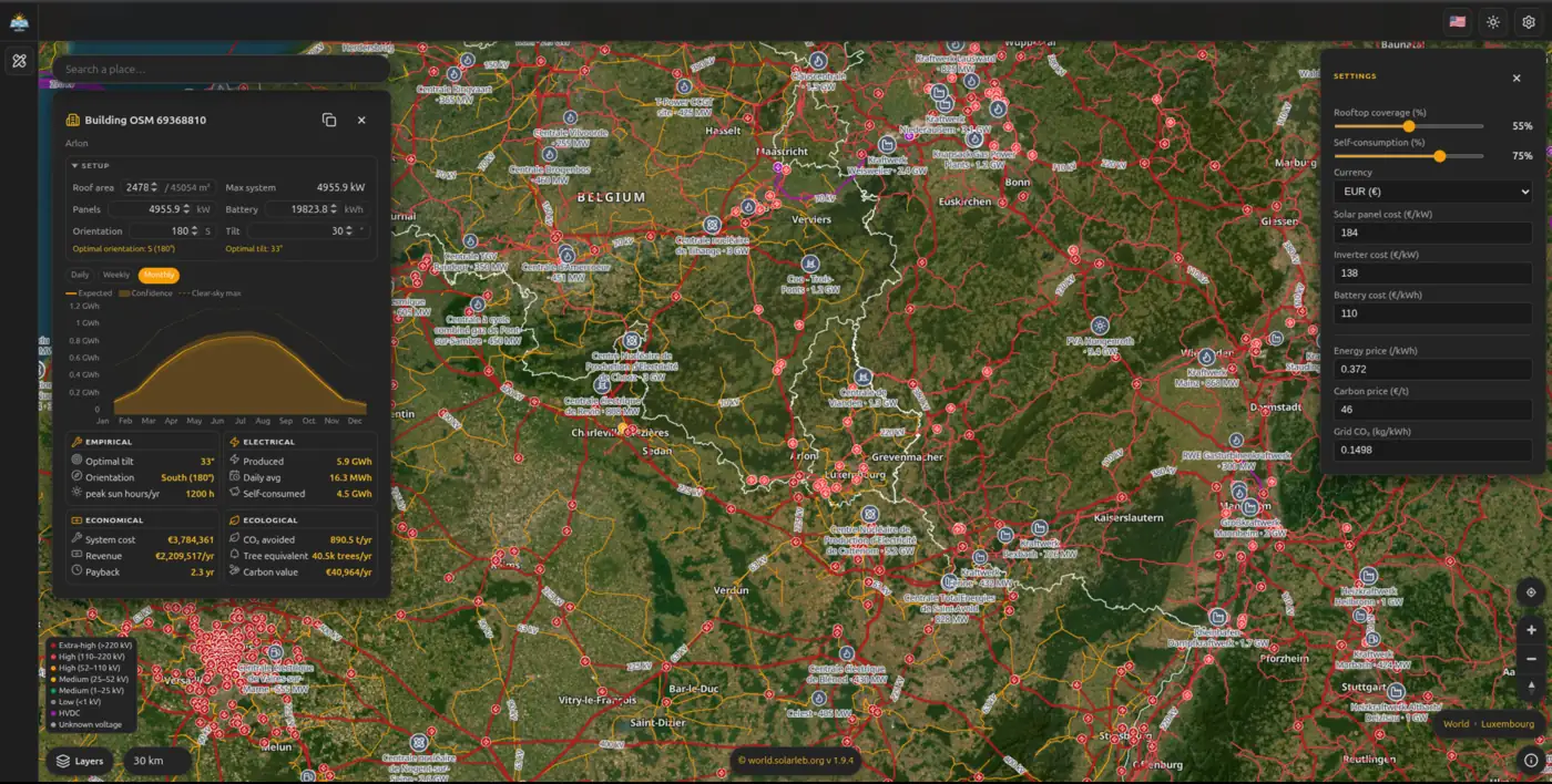
The problem
Planning solar at planetary scale means combining building footprints, rooftop geometry, terrain and irradiance — geospatial and time-series data that is too large and scattered to query together in a normal GIS-plus-database stack.
How GreyCat solves it
Geospatial + time-series in one
Building footprints, terrain and irradiance time-series live in one engine.
Every building linked
Graph-linked assets let you go from a roof to its grid context in one query.
Simulate at scale
Estimate rooftop solar potential across whole regions, not one site at a time.
Solar World maps infrastructure building by building and simulates rooftop solar — running entirely on GreyCat. Open the live map ↗